By Roger Cox
President, ACTS Now, Inc.
And if there is a difference, whose fault is it that many of us in the field don’t really know the difference? It can’t be JUST our fault. As excavators and locators, what we know about such things are, for the most part, what the sales force and GIS or mapping personnel have told us.
I recently asked Matt Brown, the Operations and Technology Director for Alabama 811, a friend and great resource to tell me in lay terms the difference if there was a difference. He said, “Simply put, a GIS program is designed to give answers to spatial questions as opposed to mapping which is created for display.”
Still more explanation was required for me. He continued, “A GIS program excels in tracking and tracing. An example would be to show me the location of all valves in the system or show me how many times we’ve repaired the water line between 2nd and 3rd Street in the past ten years. Mapping on the other hand is what we’re accustomed to in the field. Here’s the map and it looks like the water line is on the west side of the street, you can see for yourself.”
So, it sounds like a GIS system would be of tremendous benefit to any utility manager. Why isn’t it more widespread? Naturally, there are likely several reasons. It could be that some operators have invested money in a GIS system, but feel they have not gotten a return on their investment. “Why?”, you ask. Some say because the operators haven’t taken the time to learn how to use it. There is no doubt but that a GIS system provides a wealth of valuable information to the operators and managers of a utility system. Unfortunately, much of the value has been hidden behind acronyms, technical terminology, and a cloud of disconnect from how things have been done for many years. I don’t know how much Albert Einstein knew about GIS and such, but I do know one of the more famous quotes attributed to him was, “If you can’t explain it to a six-year-old, you don’t understand it yourself.”
Possibly, the cost of providing survey grade coordinates for their system was too expensive and they couldn’t see a way to budget for both the survey grade equipment and the GIS Software. Here is some good news and in easy-to-understand terminology. The technology has improved and the price for implementing a full-blown GIS system has drastically reduced. Also, did you know that you can now collect survey grade GPS data with a locating device and upload it to your maps? In the next issue of the 811 Magazine, we’re including an article on an amazing pilot program that features a Vivax vLoc3 RTK-Pro locating device. This receiver is a game changer, in that your locator in the field can collect and upload the accurate location of the utility just located.
Finally, it may be that the plan to implement the system was too comprehensive and they just couldn’t fit it into their busy schedules. I know some of you old guys (like me) are saying that maps have worked just fine for a hundred years and “that’s good enough for me to do my job.” I get it. Of course, in 1849 a covered wagon was better than walking from Joplin, Missouri to Sutter’s Mill but if you were to make the same journey today, you wouldn’t expect to see many such wagons on the highways. The truth of the matter is that GIS has been around a long time. Efforts in the late 1970’s and 1980’s were not widely successful, in part because the original use of this technology was expensive. Additionally, long range benefits were projected, but rarely realized, owing to the limitations of the available technology. That is definitely changing. You may remember the excitement of One Call systems in the early days of relational databases, digitized maps and getting away from paper maps into a spatial environment whether members were ready or not.
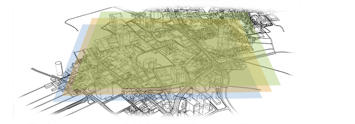
All of us in this industry know the value of accurate land base and facility maps. Technology is in place to make both maps a reality. What we need is a file system to house all the data that we have. In the past we’ve used everything from the memories of the retired folks who knew where most everything underground was, then card files and handwritten notes on maps that were later transferred to an electronic file. The GIS system is a living repository of all things data for your system. Naturally, the GIS system uses maps as the basis for all things going forward but integrates many kinds of data layers using spatial locations to tie back into the system. The system can be customized to your specific needs. An example would be, “when do I need to replace the water line between 2nd and 3rd Street because it has exceeded the threshold for reliability?” You establish the parameters, correctly identify assets, record new installations and repairs (all of which you already do somewhere) and the GIS system can then feed you information necessary to help you manage your operation, remind you of potential risks and help you make better and informed decisions, whether it is an operational or budgetary issue.
I think in the past, one of the selling points I often heard was “move your assets (including maps) into a GIS system and by doing so, you’ll make it easier for the 811 system to send accurate ticket information to you.” That’s important! But frankly that is just a byproduct of why you should be interested in finding the best system for your operation. And the most important reason to move to GIS is that it makes it easier for you to keep up with your assets that you are responsible for everyday and that the data (and maps) will be there after you and I are gone. The next manager and your system will be in your debt. Create a legacy!
After talking to my friend who has the unique ability to make technical things less technical, I’m even more excited about the role GIS will play in our industry in the upcoming years.
Just think about it and see what you can do!