By Meaghan Feeney, GIS Specialist,
and Bill Berzins, Director of IT/GIS, Tennessee 811
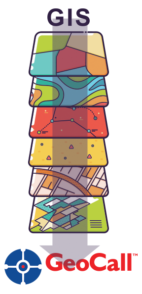
How we use GIS as a one-call system:
A Geographic Information System (GIS) is a computer system that analyzes and displays geographically referenced information. We use GIS to maintain member utility databases, or coverage areas, for the purposes of our locate-request-taking-software: “GeoCall”. GeoCall is integrated with GIS and because of this, GeoCall allows us to notify member utilities that have underground services within an area of proposed excavation. When the area of excavation is marked on the map within GeoCall, an analysis is completed in the backend of the software to create a list of member utilities to be notified within that marked area.
What makes a good utility database and what are some things to avoid?
GeoCall requires GIS data to be in shapefile format with WGS84 projection (a mathematical representation of the Earth used to reference points). Of course, we know not everyone works with the same format and projection we do. We can convert from other formats and reproject data for a member, but it is ideal to receive member databases already converted.
The more changes we must make to a member’s database, the greater the margin of error. That margin of error can make the difference in not receiving a ticket that you should have or receiving an unnecessary notification for overhead lines. One potential cause of error is sending files that represent more than just the underground components of your utility system that you want to be notified for. We’re happy to help and provide guidance as needed, but a member utility is ultimately responsible for deciding what should, or should not, be included in their coverage area.
The importance of keeping your database updated:
If a member does not regularly update their database, there is an increased risk due to non-notification. It is very important that members review their databases with TN811 at least quarterly but no more than monthly to make sure that their coverage area is up to date in our system.
It is important to note that we only make database changes (or “pushes”) into the production system on Tuesdays and Thursdays unless an emergency request is made by a member.
The easiest methods for keeping your database up-to-date are sending new files via email or using Member Service Area Mapping (MSAM). MSAM is a way for you to review your coverage area or submit changes by drawing in areas to be added or removed. You can find more information about MSAM on our website at www.tn811.com.
Buffers and how we use them:
As a safety precaution, TN811 requires members to have a buffer on service lines. Buffers help make sure a member is notified on a ticket by fighting the margin of error previously mentioned to reduce risk. Risks include database inaccuracies, map inaccuracies, human error, or even equipment error.
Members can pre-buffer their database before sending to us or we can work with members to create a buffer size that makes them feel comfortable and confident that they will be notified properly.
New trends in mapping/GIS that are relevant to utilities or damage prevention:
One new item that we have been working on within TN811 and GeoCall is a “zero buffer”. The member will be able to request that we not buffer internally but use only what they send us. In this case, their database would only consist of centerlines of their facilities without polygon buffers. Of course, we would need written/email approval of this from the member. The zero buffer “may” reduce the overall ticket volume the member receives, but no guarantees can be made. Currently, we are still testing this feature out, internally.
Within our software, we have started discussions around using vector-based location rather than raster. What this means is a faster display of mapping and ticketing, plus accuracy.
What is further out on the horizon?
New advancements and technologies in GIS within recent years include using drones for mapping of streets or other infrastructure utility assets. Other technologies include virtual headset “displays” of what is underground. Of course, this is still in early development. For this to work properly, the underground facilities must be maintained in a quality GIS. Of course, GIS software is always improving and changing. New base maps are always being improved and become more accurate.
Thank you for reading this article to learn more about our use of GIS to protect critical infrastructure. We encourage all member utilities who are still working with paper maps to migrate to a GIS, and our GIS department would be happy to discuss any questions that someone may have about migration to a GIS, or GIS in general.